Potential and limitations of free online PPP services in master base positioning: a case study along the Sirba river in sub-Saharan Africa
Keywords:
PPP, GNSS, RTK, sub-Saharan AfricaAbstract
The use of GNSS dual frequency receivers is consolidated in many fields and in the last years the employment of this technology has
spread also for emergency services, as support to natural risk forecast modelling and environmental monitoring. The diffusion of
GNSS techniques has increased thanks to the growing number of satellites, the new infrastructure (such permanent stations
networks). The growing number of satellite constellations amplifies the potentiality of the Precise Point Positioning (PPP) technique.
Untill some years ago, this technique was limited by long sessions of measurements to obtain good precisions (cm), using only one
GNSS dual frequency receiver. Nowadays, exists online PPP free services that permit a broad access to PPP technique. In this
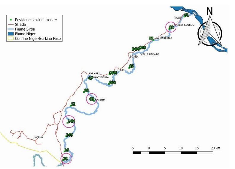
contribution PPP online services are analysed as potential solutions for realizing GNSS surveys in areas considered disadvantaged for
their lack of infrastructure. Particularly, three PPP online services (Canadian Spatial Reference System Precise Point Positioning tool
(CSRS-PPP); Automatic Precise Positioning Service (APPS); AUSPOS Online GPS processing service) are compared, and their
elaboration abilities for different durations of data record (three scenarios of 3 hrs, 1 hrs and 30 minutes) are analysed. The data for
the analysis were collected in south-west Niger, along the Sirba river (Niger, Africa). The results reveal precisions and relative
accuracies lower than 5 cm for three hours’ session and satisfy the needs of the project. From the analysis of the short observation
sessions (i.e. one hour and half hour) emerged that APPS provides the best precision values: between 0,031cm and 0,272 cm. The
less performant service is AUSPOS that for one hour of data record provides 0,612 cm precision. CSRS-PPP has precision values
between the ones of AUSPOS and APPS.
Downloads
Downloads
Published
How to Cite
Issue
Section
License

This work is licensed under a Creative Commons Attribution-ShareAlike 4.0 International License.

