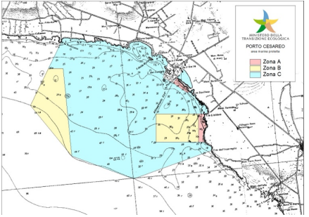
L’area marina protetta di Porto Cesareo: un esempio per l’integrazione delle pratiche di rilievo fotogrammetrico nella pianificazione dello spazio marittimo per la tutela dell’Underwater Cultural Heritage (UCH)
Abstract
Underwater Cultural Heritage (UCH) represents a fundamental component of the cultural and landscape resources of coastal and maritime spaces, including submerged archaeological sites, ancient coastal infrastructures, and historical landscapes related to sea level changes and coastal dynamics (Depellegrin et al., 2019). This non-renewable heritage is essential for preserving historical, cultural, and scientific value, but its management is often hindered by gaps in available data and the need for specific tools for documentation and protection (Ramieri et al., 2024). Enhancing these resources contributes not only to our understanding of history but also to the promotion of sustainable tourism and the Blue Economy, underlining the need for innovative approaches to ensure their safeguarding (Barianaki et al., 2024).
Downloads
Downloads
Published
How to Cite
Issue
Section
License

This work is licensed under a Creative Commons Attribution-ShareAlike 4.0 International License.

