RILIEVO DI GIARDINI STORICI: FOTOGRAMMETRIA MULTI-CAMERA E LASER SCANNER PORTATILE A CONFRONTO
Abstract
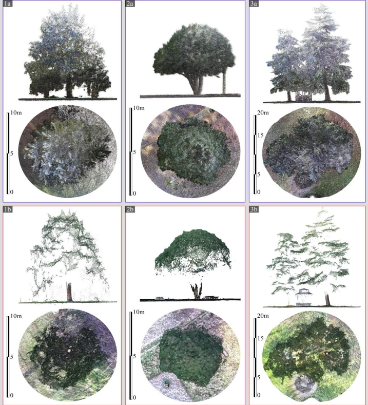
This paper presents an investigation into the characterization of historic gardens by comparing two 3D survey methodologies. In this context, approaches employing static laser scanners are considered the most accurate, while portable laser scanners are considered promising due to their extreme productivity. Less common is the use of photogrammetry. This paper compares two approaches based on the use of a wearable Mobile Mapping System (MMS) and the use of a multi-camera photogrammetric prototype. The comparison aims to assess the applicability of the two techniques in this field, evaluating their advantages and disadvantages in surveying a historic garden and extracting information regarding trees, such as DBH (Diameter at Breast Height) and canopy footprint. We compared the practicality of surveying and processing operations and the quality and characteristics of the point clouds obtained. Both systems produced a dense representation of the terrain. The multi-camera survey was more defined due to less point cloud noise, but incomplete in the definition of tree crowns. DBH of tree trunks could be extracted with both systems, except for thinner and finer diameter trunks detected by the MMS approach, but not always by the multi-camera. The MMS approach proved to be more effective due to the shorter survey time required to cover an equal area and the fact that the MMS survey alone is sufficient for the geometric description of trees. In contrast, the multi-camera approach cannot avoid integration with an aerial survey for canopy reconstruction.
Downloads
Published
How to Cite
Issue
Section
License
Copyright (c) 2025 Luca Perfetti, Giorgio Vassena, Francesco Fassi (Autore)

This work is licensed under a Creative Commons Attribution-ShareAlike 4.0 International License.

