MULTISPECTRAL IMAGERY TO SUPPORT URBAN PLANNING AND CIM (CITY INFORMATION MODELING)
Abstract
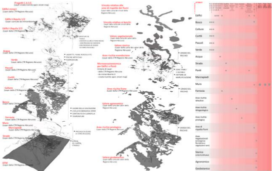
This work presents a study on processing additional information using high and medium-resolution multispectral satellite images. The new information will be derived from specific spectral indices as well as clustering algorithms. The primary objective is to gain novel insights for updating existing information, sourced from official regional authorities. Subsequently, the acquired data will be amalgamated into an updated and unified database, thus constituting an extended 3D urban model known as CIM (City Information Modeling). This model will serve as a valuable asset for urban planning and management, creating a comprehensive parametric representation of the subject city. A wide array of information types can be associated with this model, contributing to the monitoring and effective administration of the urban area.
Downloads
Downloads
Published
How to Cite
Issue
Section
License
Copyright (c) 2025 Nicole Pascucci (Autore)

This work is licensed under a Creative Commons Attribution-ShareAlike 4.0 International License.

