Estimation Analysis of Photovoltaic Energy Production Potential of Civil Buildings in an Urban Context Using QGIS
Abstract
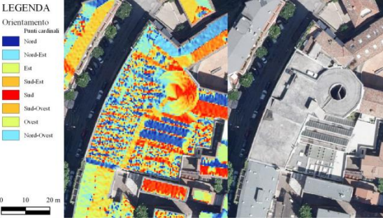
QGIS is an open source geospatial software that offers countless functions to perform analysis on the territory, and it is for this reason that through it we have chosen to carry out an investigation in the field of renewable sources for clean energy production, using the open data of the cartographic database of the Friuli Venezia Giulia Region. The purpose of this paper is to illustrate how the elaboration of the analysis aimed at determining the estimated annual electricity production that a given photovoltaic system could offer if installed on the roofs of civil buildings located in an urban context takes place. To obtain this estimate, we focused on the geometric properties that characterize the architectural elements of the buildings, such as the slope and orientation of the surfaces that make up the roof and on which their solar exposure over the time span of an entire year depends. Then, data obtained from the Photovoltaic Geographical Information System simulator were applied by setting the parameters of a specific solar panel system. Thus, it was possible to determine, for each area of building coverage in the area under consideration, an estimate of the amount of annual energy that the selected system would be able to generate.
Downloads
Downloads
Published
How to Cite
Issue
Section
License
Copyright (c) 2025 Pietro Tagliariol (Autore)

This work is licensed under a Creative Commons Attribution-ShareAlike 4.0 International License.

